 vesseltracker.com
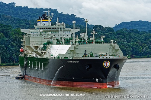
Maria Energy
Current StatusWhere is the vessel?
Maria Energy is currently in Open sea (no nearby ports in database), based on AIS data received less than 1h ago.
Latest AIS update:
Current position: 40.96583° N, 170.04099° W (Open sea (no nearby ports in database))
Average speed (last 7 days): Loading…
Average speed (last 30 days): Loading…
Vessel profile: Maria Energy is a Lng Tanker with dimensions 46m x 289m.
This page combines live AIS, route history, probable destination signals, nearby traffic, and port activity for practical vessel monitoring.
The current position of vessel Maria Energy is 40.96583 lat / -170.04099 lng. Updated: 2026-05-16 12:19:10 UTCNearest reference points:
- Open sea (no nearby ports in database)
Details:
Live Vessel Maria Energy Analytics (details, animations, etc.)
Recent AIS points (UTC):
2026-05-16 07:23:37 UTC · 40.98608, -171.32925 · SOG 12.1 kn · COG 90°2026-05-16 10:10:39 UTC · 40.95591, -170.59737 · SOG 11.7 kn · COG 90°
2026-05-16 10:24:22 UTC · 40.95313, -170.53880 · SOG 11.5 kn · COG 90°
2026-05-16 12:19:10 UTC · 40.96583, -170.04099 · SOG 11.8 kn · COG 70°