 vesseltracker.com
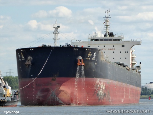
 AGRI BRIGHT
Current Status
Where is the vessel?
AGRI BRIGHT is currently in Near Kamsar, based on AIS data received about 1h ago.
Latest AIS update:
Current position: 10.64169° N, 14.62892° W (Near Kamsar)
Average speed (last 7 days): Loading…
Average speed (last 30 days): Loading…
Vessel profile: AGRI BRIGHT is a Bulk Carrier with dimensions 225m x 32m.
This page combines live AIS, route history, probable destination signals, nearby traffic, and port activity for practical vessel monitoring.
The current position of vessel AGRI BRIGHT is 10.64169 lat / -14.62892 lng. Updated: 2026-05-15 17:19:59 UTCNearest reference points:
- Near Dougoula
- Near Port de Boké
- 14 nm S of Port de Boké
Currently sailing under the flag of Marshall Islands ![]()
AGRI BRIGHT built in 2013 year
Deadweight:
74632 tDetails:
Live Vessel AGRI BRIGHT Analytics (details, animations, etc.)
Recent AIS points (UTC):
2026-05-15 13:50:56 UTC · 10.48676, -14.73065 · SOG 3.5 kn · COG 8°2026-05-15 15:52:53 UTC · 10.64176, -14.62894 · SOG 0.2 kn · COG 199°
2026-05-15 16:34:57 UTC · 10.64171, -14.62898 · SOG 0 kn · COG 199°
2026-05-15 17:19:59 UTC · 10.64169, -14.62892 · SOG 0 kn · COG 199°