 vesseltracker.com
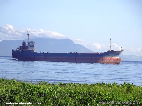
Maritime 19
Current StatusWhere is the vessel?
Maritime 19 is currently in Near Port Kelang, based on AIS data received about 2h ago.
Latest AIS update:
Current position: 2.99298° N, 101.39355° E (Near Port Kelang)
Average speed (last 7 days): Loading…
Average speed (last 30 days): Loading…
Vessel profile: Maritime 19 is a General Cargo Ship with dimensions 16m x 92m.
This page combines live AIS, route history, probable destination signals, nearby traffic, and port activity for practical vessel monitoring.
The current position of vessel Maritime 19 is 2.99298 lat / 101.39355 lng. Updated: 2026-05-14 23:44:50 UTCNearest reference points:
- Near Port Swettenham
- Near PORT KLANG
- Near Port Klang (Ferry Port)
Details:
Live Vessel Maritime 19 Analytics (details, animations, etc.)
Recent AIS points (UTC):
2026-05-14 20:15:08 UTC · 2.83669, 101.25618 · SOG 5.9 kn · COG 350°2026-05-14 22:11:44 UTC · 2.98281, 101.32295 · SOG 3.5 kn · COG 53°
2026-05-14 22:31:12 UTC · 2.99908, 101.34351 · SOG 5.1 kn · COG 45°
2026-05-14 23:44:50 UTC · 2.99298, 101.39355 · SOG 0 kn · COG 165°