 vesseltracker.com
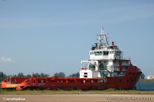
Setia Hijrah
Current StatusWhere is the vessel?
Setia Hijrah is currently in 22 nm W of Hazira Port/Surat, based on AIS data received about 2h ago.
Latest AIS update:
Current position: 21.08571° N, 72.21623° E (22 nm W of Hazira Port/Surat)
Average speed (last 7 days): Loading…
Average speed (last 30 days): Loading…
Vessel profile: Setia Hijrah is a Offshore Tug Supply Ship with dimensions 16m x 76m.
This page combines live AIS, route history, probable destination signals, nearby traffic, and port activity for practical vessel monitoring.
The current position of vessel Setia Hijrah is 21.08571 lat / 72.21623 lng. Updated: 2026-04-30 11:27:26 UTCNearest reference points:
- Near Mithivirdi
- Near Gandhar
- Near DAHEJ
Details:
Live Vessel Setia Hijrah Analytics (details, animations, etc.)
Recent AIS points (UTC):
2026-04-29 09:55:38 UTC · 21.09877, 72.26314 · SOG 0 kn · COG 359°2026-04-29 09:55:38 UTC · 21.09877, 72.26314 · SOG 0 kn · COG 359°
2026-04-30 11:27:26 UTC · 21.08571, 72.21623 · SOG 2.9 kn · COG 219°
2026-04-30 11:27:26 UTC · 21.08571, 72.21623 · SOG 2.9 kn · COG 219°