 vesseltracker.com
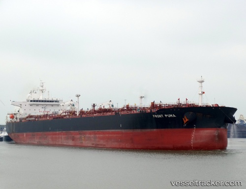
 SFL PUMA
Current Status
Where is the vessel?
SFL PUMA is currently in 317 nm SW of Harper, based on AIS data received less than 1h ago.
Latest AIS update:
Current position: 0.43757° S, 9.89642° W (317 nm SW of Harper)
Average speed (last 7 days): Loading…
Average speed (last 30 days): Loading…
Vessel profile: SFL PUMA is a Crude Oil Tanker with dimensions m x m.
This page combines live AIS, route history, probable destination signals, nearby traffic, and port activity for practical vessel monitoring.
The current position of vessel SFL PUMA is -0.43757 lat / -9.89642 lng. Updated: 2026-05-15 07:33:58 UTCNearest reference points:
- Open sea, approx. 400 nm off the nearest listed port
- Open sea, approx. 401 nm off the nearest listed port
- Open sea, approx. 403 nm off the nearest listed port
Currently sailing under the flag of Marshall Islands ![]()
SFL PUMA built in 2015 year
Deadweight:
99993 tDetails:
Live Vessel SFL PUMA Analytics (details, animations, etc.)
Recent AIS points (UTC):
2026-05-15 03:45:18 UTC · 0.17736, -10.34660 · SOG 11.6 kn · COG 141°2026-05-15 05:03:20 UTC · -0.02887, -10.19862 · SOG 12 kn · COG 146°
2026-05-15 05:53:09 UTC · -0.16580, -10.10078 · SOG 12.1 kn · COG 142°
2026-05-15 07:33:58 UTC · -0.43757, -9.89642 · SOG 12.2 kn · COG 144°