 vesseltracker.com
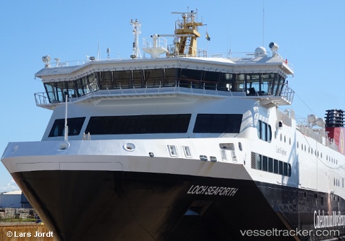
 Loch Seaforth
Current Status
Where is the vessel?
Loch Seaforth is currently in Near ULLAPOOL, based on AIS data received less than 1h ago.
Latest AIS update:
Current position: 57.89403° N, 5.15906° W (Near ULLAPOOL)
Average speed (last 7 days): Loading…
Average speed (last 30 days): Loading…
Vessel profile: Loch Seaforth is a Passenger Ro Ro Cargo Ship with dimensions 116m x 19m.
This page combines live AIS, route history, probable destination signals, nearby traffic, and port activity for practical vessel monitoring.
The current position of vessel Loch Seaforth is 57.89403 lat / -5.15906 lng. Updated: 2026-05-18 01:33:45 UTCNearest reference points:
- Near Culkein
- Near KYLE OF LOCHALSH
- Near Inverness
Currently sailing under the flag of United Kingdom ![]()
Details:
Live Vessel Loch Seaforth Analytics (details, animations, etc.)
Recent AIS points (UTC):
2026-05-17 22:19:00 UTC · 58.04658, -5.94307 · SOG 19 kn · COG 124°2026-05-17 23:31:00 UTC · 57.93644, -5.28829 · SOG 19.2 kn · COG 108°
2026-05-18 01:27:44 UTC · 57.89405, -5.15901 · SOG 0 kn · COG 143°
2026-05-18 01:33:45 UTC · 57.89403, -5.15906 · SOG 0 kn · COG 143°