 vesseltracker.com
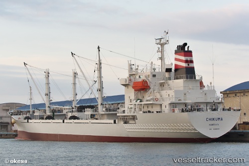
 CHIKUMA
Current Status
Where is the vessel?
CHIKUMA is currently in Near Shimizu, based on AIS data received about 1h ago.
Latest AIS update:
Current position: 35.04002° N, 138.51405° E (Near Shimizu)
Average speed (last 7 days): Loading…
Average speed (last 30 days): Loading…
Vessel profile: CHIKUMA is a Refrigerated Cargo Ship with dimensions 134m x 20m.
This page combines live AIS, route history, probable destination signals, nearby traffic, and port activity for practical vessel monitoring.
The current position of vessel CHIKUMA is 35.04002 lat / 138.51405 lng. Updated: 2026-04-30 04:52:16 UTCNearest reference points:
- Near Shimizu
- Near OMAEZAKI
- Near Iruma
Currently sailing under the flag of Panama ![]()
CHIKUMA built in 2013 year
Deadweight:
7303 tDetails:
Live Vessel CHIKUMA Analytics (details, animations, etc.)
Recent AIS points (UTC):
2026-04-30 01:25:16 UTC · 35.04000, 138.51405 · SOG 0 kn · COG 164°2026-04-30 01:31:16 UTC · 35.03998, 138.51408 · SOG 0 kn · COG 163°
2026-04-30 04:04:21 UTC · 35.03999, 138.51408 · SOG 0 kn · COG 164°
2026-04-30 04:52:16 UTC · 35.04002, 138.51405 · SOG 0 kn · COG 164°