 vesseltracker.com
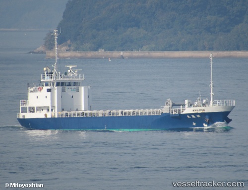
Seiryumaru
Current StatusWhere is the vessel?
Seiryumaru is currently in Near Toyonaka, based on AIS data received less than 1h ago.
Latest AIS update:
Current position: 34.59036° N, 135.46251° E (Near Toyonaka)
Average speed (last 7 days): Loading…
Average speed (last 30 days): Loading…
Vessel profile: Seiryumaru is a General Cargo Ship with dimensions 10m x 61m.
This page combines live AIS, route history, probable destination signals, nearby traffic, and port activity for practical vessel monitoring.
The current position of vessel Seiryumaru is 34.59036 lat / 135.46251 lng. Updated: 2026-04-26 07:54:43 UTCNearest reference points:
- Near SAKAI
- Near Nada-Ku, Hyogo
- Near Kobe
Details:
Live Vessel Seiryumaru Analytics (details, animations, etc.)
Recent AIS points (UTC):
2026-04-26 04:36:43 UTC · 34.59030, 135.46252 · SOG 0 kn · COG 272°2026-04-26 05:21:43 UTC · 34.59036, 135.46255 · SOG 0 kn · COG 272°
2026-04-26 07:21:43 UTC · 34.59036, 135.46249 · SOG 0 kn · COG 272°
2026-04-26 07:54:43 UTC · 34.59036, 135.46251 · SOG 0 kn · COG 272°