 vesseltracker.com
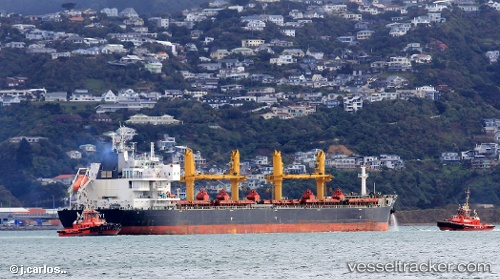
 COMMON ATLAS
Current Status
Where is the vessel?
COMMON ATLAS is currently in Near Chittagong, based on AIS data received less than 1h ago.
Latest AIS update:
Current position: 22.27313° N, 91.74471° E (Near Chittagong)
Average speed (last 7 days): Loading…
Average speed (last 30 days): Loading…
Vessel profile: COMMON ATLAS is a Bulk Carrier with dimensions 200m x 200m.
This page combines live AIS, route history, probable destination signals, nearby traffic, and port activity for practical vessel monitoring.
The current position of vessel COMMON ATLAS is 22.27313 lat / 91.74471 lng. Updated: 2026-05-02 21:33:21 UTCNearest reference points:
- Near Chittagong
- 12 nm NW of Chattogram
- 23 nm NW of Cox's Bazar
Currently sailing under the flag of Marshall Islands ![]()
COMMON ATLAS built in 2014 year
Deadweight:
62985 tDetails:
Live Vessel COMMON ATLAS Analytics (details, animations, etc.)
Recent AIS points (UTC):
2026-05-02 17:27:21 UTC · 22.27711, 91.74195 · SOG 0.1 kn · COG 161°2026-05-02 19:57:21 UTC · 22.27707, 91.74232 · SOG 0 kn · COG 174°
2026-05-02 20:18:21 UTC · 22.27712, 91.74226 · SOG 0.1 kn · COG 164°
2026-05-02 21:33:21 UTC · 22.27313, 91.74471 · SOG 0.2 kn · COG 346°