 vesseltracker.com
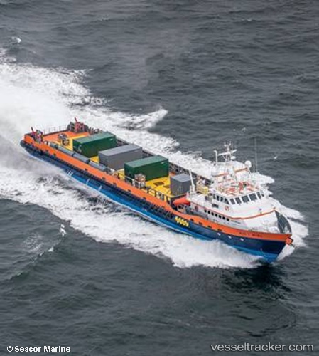
 ALEX F MCCALL
Current Status
Where is the vessel?
ALEX F MCCALL is currently in Near AL JUBAIL, based on AIS data received less than 1h ago.
Latest AIS update:
Current position: 27.18279° N, 49.69683° E (Near AL JUBAIL)
Average speed (last 7 days): Loading…
Average speed (last 30 days): Loading…
Vessel profile: ALEX F MCCALL is a Offshore Supply Ship with dimensions 61m x 11m.
This page combines live AIS, route history, probable destination signals, nearby traffic, and port activity for practical vessel monitoring.
The current position of vessel ALEX F MCCALL is 27.18279 lat / 49.69683 lng. Updated: 2026-05-14 07:44:37 UTCNearest reference points:
- Near Al Jubayl
- 13 nm NE of AL JUBAIL
- Near Al Jubayl Industrial City
Currently sailing under the flag of Marshall Islands ![]()
ALEX F MCCALL built in 2014 year
Deadweight:
508 tDetails:
Live Vessel ALEX F MCCALL Analytics (details, animations, etc.)
Recent AIS points (UTC):
2026-05-14 03:59:30 UTC · 27.32775, 49.98807 · SOG 8.2 kn · COG 252°2026-05-14 04:57:41 UTC · 27.28668, 49.84626 · SOG 8.3 kn · COG 250°
2026-05-14 06:02:58 UTC · 27.23246, 49.75240 · SOG 2.4 kn · COG 235°
2026-05-14 07:44:37 UTC · 27.18279, 49.69683 · SOG 10.9 kn · COG 323°