 vesseltracker.com
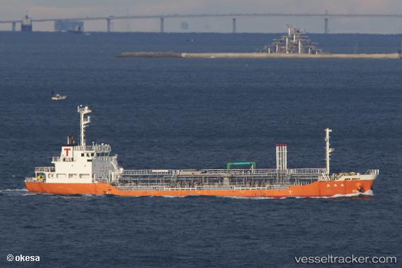
 Taiyo Maru
Current Status
Where is the vessel?
Taiyo Maru is currently in Near Aomori, based on AIS data received less than 1h ago.
Latest AIS update:
Current position: 40.83193° N, 140.75504° E (Near Aomori)
Average speed (last 7 days): Loading…
Average speed (last 30 days): Loading…
Vessel profile: Taiyo Maru is a Oil Products Tanker with dimensions 79m x 12m.
This page combines live AIS, route history, probable destination signals, nearby traffic, and port activity for practical vessel monitoring.
The current position of vessel Taiyo Maru is 40.83193 lat / 140.75504 lng. Updated: 2026-04-25 21:32:37 UTCNearest reference points:
- Near Yokohama, Aomori
- 11 nm NW of Yokohama, Aomori
- 23 nm NE of SAI
Currently sailing under the flag of Japan ![]()
Details:
Live Vessel Taiyo Maru Analytics (details, animations, etc.)
Recent AIS points (UTC):
2026-04-25 17:29:39 UTC · 40.83197, 140.75497 · SOG 0 kn · COG 260°2026-04-25 19:32:35 UTC · 40.83192, 140.75502 · SOG 0 kn · COG 261°
2026-04-25 19:35:34 UTC · 40.83191, 140.75505 · SOG 0 kn · COG 261°
2026-04-25 21:32:37 UTC · 40.83193, 140.75504 · SOG 0 kn · COG 261°