 vesseltracker.com
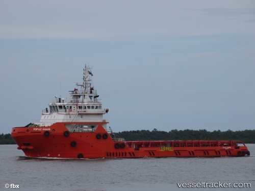
 TOPAZ AMANI
Current Status
Where is the vessel?
TOPAZ AMANI is currently in 53 nm SE of MOCIMBOA DA PRAIA, based on AIS data received about 1h ago.
Latest AIS update:
Current position: 12.02450° S, 40.93167° E (53 nm SE of MOCIMBOA DA PRAIA)
Average speed (last 7 days): Loading…
Average speed (last 30 days): Loading…
Vessel profile: TOPAZ AMANI is a Offshore Supply Ship with dimensions 17m x 75m.
This page combines live AIS, route history, probable destination signals, nearby traffic, and port activity for practical vessel monitoring.
The current position of vessel TOPAZ AMANI is -12.02450 lat / 40.93167 lng. Updated: 2026-05-15 00:10:59 UTCNearest reference points:
- Near Mtwara
- 47 nm NW of Mohéli Apt
- 10 nm N of NACALA PORTO
Currently sailing under the flag of Marshall Islands ![]()
TOPAZ AMANI built in 2013 year
Deadweight:
3130 tDetails:
Live Vessel TOPAZ AMANI Analytics (details, animations, etc.)
Recent AIS points (UTC):
2026-05-14 20:14:13 UTC · -12.42858, 40.81967 · SOG 6.3 kn · COG 6°2026-05-14 21:31:09 UTC · -12.29500, 40.85500 · SOG 6 kn · COG -1°
2026-05-14 22:37:09 UTC · -12.18167, 40.88667 · SOG 6 kn · COG -1°
2026-05-15 00:10:59 UTC · -12.02450, 40.93167 · SOG 6.1 kn · COG 14°