 vesseltracker.com
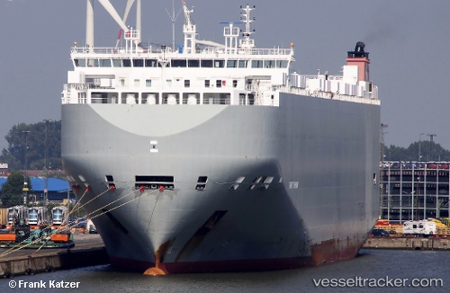
 Gravity Highway
Current Status
Where is the vessel?
Gravity Highway is currently in 22 nm SE of Laurieton, based on AIS data received about 1h ago.
Latest AIS update:
Current position: 31.94539° S, 153.05945° E (22 nm SE of Laurieton)
Average speed (last 7 days): Loading…
Average speed (last 30 days): Loading…
Vessel profile: Gravity Highway is a Vehicles Carrier with dimensions 200m x 32m.
This page combines live AIS, route history, probable destination signals, nearby traffic, and port activity for practical vessel monitoring.
The current position of vessel Gravity Highway is -31.94539 lat / 153.05945 lng. Updated: 2026-05-14 20:23:04 UTCNearest reference points:
- Near Warners Bay
- Near Caves Beach
- Near BILGOLA PLATEAU
Currently sailing under the flag of Bahamas ![]()
Gravity Highway built in 2014 year
Deadweight:
19974 tDetails:
Live Vessel Gravity Highway Analytics (details, animations, etc.)
Recent AIS points (UTC):
2026-05-14 16:54:54 UTC · -32.62857, 152.80069 · SOG 11.9 kn · COG 29°2026-05-14 17:43:05 UTC · -32.48336, 152.87993 · SOG 11.4 kn · COG 24°
2026-05-14 19:43:43 UTC · -32.07974, 153.01105 · SOG 12.6 kn · COG 18°
2026-05-14 20:23:04 UTC · -31.94539, 153.05945 · SOG 12.7 kn · COG 15°