 vesseltracker.com
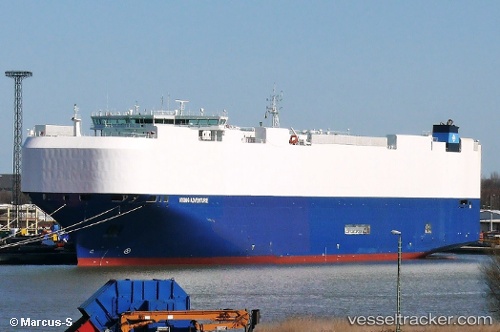
 VIKING ADVENTURE
Current Status
Where is the vessel?
VIKING ADVENTURE is currently in 39 nm S of BARRA DE NAVIDAD, based on AIS data received about 3h ago.
Latest AIS update:
Current position: 18.57136° N, 104.85452° W (39 nm S of BARRA DE NAVIDAD)
Average speed (last 7 days): Loading…
Average speed (last 30 days): Loading…
Vessel profile: VIKING ADVENTURE is a Vehicles Carrier with dimensions 199m x 32m.
This page combines live AIS, route history, probable destination signals, nearby traffic, and port activity for practical vessel monitoring.
The current position of vessel VIKING ADVENTURE is 18.57136 lat / -104.85452 lng. Updated: 2026-04-14 23:58:44 UTCNearest reference points:
- 46 nm S of El Ranchito
- 43 nm SW of Antunez
- Near NUEVO VALLARTA
Currently sailing under the flag of Marshall Islands ![]()
VIKING ADVENTURE built in 2015 year
Deadweight:
18372 tDetails:
Live Vessel VIKING ADVENTURE Analytics (details, animations, etc.)
Recent AIS points (UTC):
2026-04-14 17:52:38 UTC · 18.02363, -103.29450 · SOG 15 kn · COG 288°2026-04-14 20:01:21 UTC · 18.21405, -103.84721 · SOG 15.6 kn · COG 291°
2026-04-14 21:38:11 UTC · 18.36601, -104.26075 · SOG 15.1 kn · COG 291°
2026-04-14 23:58:44 UTC · 18.57136, -104.85452 · SOG 15.4 kn · COG 286°