 vesseltracker.com
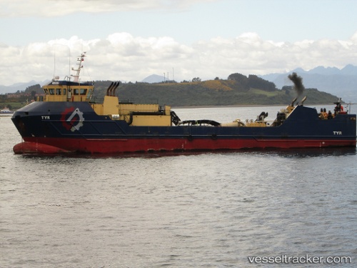
Tyr
Current StatusWhere is the vessel?
Tyr is currently in Near Puerto Natales, based on AIS data received about 2h ago.
Latest AIS update:
Current position: 51.69794° S, 72.52799° W (Near Puerto Natales)
Average speed (last 7 days): Loading…
Average speed (last 30 days): Loading…
Vessel profile: Tyr is a Fish Carrier with dimensions 14m x 63m.
This page combines live AIS, route history, probable destination signals, nearby traffic, and port activity for practical vessel monitoring.
The current position of vessel Tyr is -51.69794 lat / -72.52799 lng. Updated: 2026-04-25 19:54:28 UTCDetails:
Live Vessel Tyr Analytics (details, animations, etc.)
Recent AIS points (UTC):
2026-04-25 16:00:29 UTC · -51.69798, -72.52797 · SOG 0 kn · COG 312°2026-04-25 17:24:25 UTC · -51.69798, -72.52796 · SOG 0 kn · COG 312°
2026-04-25 19:27:26 UTC · -51.69797, -72.52801 · SOG 0 kn · COG 311°
2026-04-25 19:54:28 UTC · -51.69794, -72.52799 · SOG 0 kn · COG 312°