 vesseltracker.com
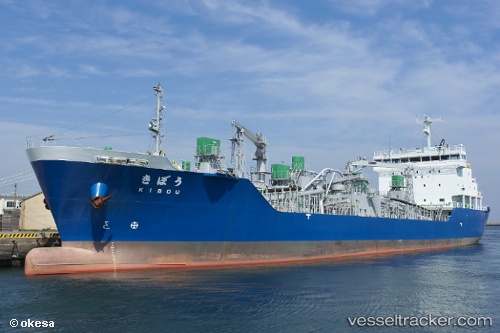
Kibou
Current StatusWhere is the vessel?
Kibou is currently in Near Hachinohe, based on AIS data received about 6h ago.
Latest AIS update:
Current position: 40.53055° N, 141.54546° E (Near Hachinohe)
Average speed (last 7 days): Loading…
Average speed (last 30 days): Loading…
Vessel profile: Kibou is a Limestone Carrier with dimensions 17m x 105m.
This page combines live AIS, route history, probable destination signals, nearby traffic, and port activity for practical vessel monitoring.
The current position of vessel Kibou is 40.53055 lat / 141.54546 lng. Updated: 2026-04-27 11:02:47 UTCNearest reference points:
- 26 nm E of Hachinohe
- Near Yokohama, Aomori
- 11 nm NW of Yokohama, Aomori
Details:
Live Vessel Kibou Analytics (details, animations, etc.)
Recent AIS points (UTC):
2026-04-27 11:02:47 UTC · 40.53055, 141.54546 · SOG 0 kn · COG 175°2026-04-27 11:02:47 UTC · 40.53055, 141.54546 · SOG 0 kn · COG 175°
2026-04-27 11:02:47 UTC · 40.53055, 141.54546 · SOG 0 kn · COG 175°
2026-04-27 11:02:47 UTC · 40.53055, 141.54546 · SOG 0 kn · COG 175°