 vesseltracker.com
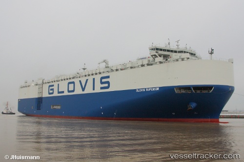
 GLOVIS SUPERIOR
Current Status
Where is the vessel?
GLOVIS SUPERIOR is currently in 40 nm SW of Port Saint John's, based on AIS data received less than 1h ago.
Latest AIS update:
Current position: 32.23789° S, 29.20662° E (40 nm SW of Port Saint John's)
Average speed (last 7 days): Loading…
Average speed (last 30 days): Loading…
Vessel profile: GLOVIS SUPERIOR is a Vehicles Carrier with dimensions 199m x 35m.
This page combines live AIS, route history, probable destination signals, nearby traffic, and port activity for practical vessel monitoring.
The current position of vessel GLOVIS SUPERIOR is -32.23789 lat / 29.20662 lng. Updated: 2026-05-15 04:18:14 UTCNearest reference points:
- 23 nm E of Port Saint John's
- Near Island View
- Near Durban
Currently sailing under the flag of Korea (Republic of) ![]()
GLOVIS SUPERIOR built in 2013 year
Deadweight:
20138 tDetails:
Live Vessel GLOVIS SUPERIOR Analytics (details, animations, etc.)
Recent AIS points (UTC):
2026-05-14 23:58:44 UTC · -31.32937, 30.16254 · SOG 16.1 kn · COG 221°2026-05-15 01:02:02 UTC · -31.54583, 29.93645 · SOG 17.2 kn · COG 223°
2026-05-15 04:05:03 UTC · -32.19077, 29.25525 · SOG 16.6 kn · COG 223°
2026-05-15 04:18:14 UTC · -32.23789, 29.20662 · SOG 16.9 kn · COG 223°