 vesseltracker.com
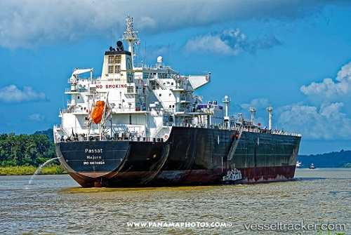
Passat
Current StatusWhere is the vessel?
Passat is currently in 54 nm NE of The Valley, based on AIS data received less than 1h ago.
Latest AIS update:
Current position: 18.87582° N, 62.41089° W (54 nm NE of The Valley)
Average speed (last 7 days): Loading…
Average speed (last 30 days): Loading…
Vessel profile: Passat is a Lpg Tanker with dimensions 37m x 226m.
This page combines live AIS, route history, probable destination signals, nearby traffic, and port activity for practical vessel monitoring.
The current position of vessel Passat is 18.87582 lat / -62.41089 lng. Updated: 2026-05-15 01:22:12 UTCNearest reference points:
- Near ST MAARTEN
- Near GUSTAVIA
- 126 nm NE of Sombrero
Details:
Live Vessel Passat Analytics (details, animations, etc.)
Recent AIS points (UTC):
2026-05-14 21:23:03 UTC · 18.56227, -61.42774 · SOG 14.9 kn · COG 291°2026-05-14 22:02:55 UTC · 18.61896, -61.59002 · SOG 14.8 kn · COG 289°
2026-05-15 00:08:43 UTC · 18.77965, -62.10851 · SOG 14.8 kn · COG 289°
2026-05-15 01:22:12 UTC · 18.87582, -62.41089 · SOG 15 kn · COG 286°