 vesseltracker.com
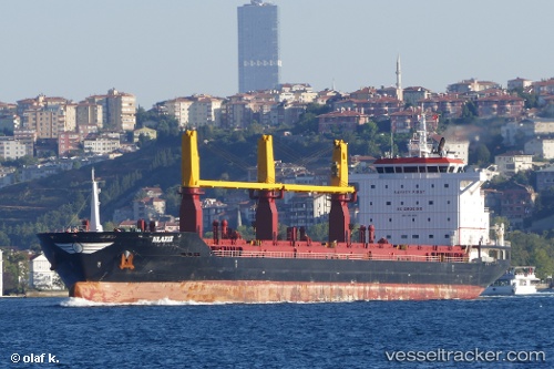
 STELLINA
Current Status
Where is the vessel?
STELLINA is currently in 390 nm S of Achau, based on AIS data received about 1h ago.
Latest AIS update:
Current position: 42.30268° N, 160.59187° W (390 nm S of Achau)
Average speed (last 7 days): Loading…
Average speed (last 30 days): Loading…
Vessel profile: STELLINA is a General Cargo with dimensions m x m.
This page combines live AIS, route history, probable destination signals, nearby traffic, and port activity for practical vessel monitoring.
The current position of vessel STELLINA is 42.30268 lat / -160.59187 lng. Updated: 2026-05-13 20:12:56 UTCNearest reference points:
- Open sea, approx. 406 nm off the nearest listed port
- Open sea, approx. 407 nm off the nearest listed port
- Open sea, approx. 401 nm off the nearest listed port
Currently sailing under the flag of Malta ![]()
Details:
Live Vessel STELLINA Analytics (details, animations, etc.)
Recent AIS points (UTC):
2026-05-13 16:48:27 UTC · 42.16018, -161.42938 · SOG 11.8 kn · COG 66°2026-05-13 17:32:08 UTC · 42.20414, -161.25508 · SOG 10.9 kn · COG 72°
2026-05-13 19:40:17 UTC · 42.28196, -160.72572 · SOG 11 kn · COG 76°
2026-05-13 20:12:56 UTC · 42.30268, -160.59187 · SOG 11.5 kn · COG 77°