 vesseltracker.com
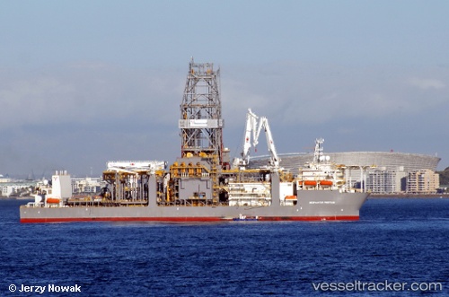
Deepwater Proteus
Current StatusWhere is the vessel?
Deepwater Proteus is currently in Near Loop Terminal, based on AIS data received about 1h ago.
Latest AIS update:
Current position: 28.84349° N, 90.11015° W (Near Loop Terminal)
Average speed (last 7 days): Loading…
Average speed (last 30 days): Loading…
Vessel profile: Deepwater Proteus is a Drilling Ship with dimensions 42m x 238m.
This page combines live AIS, route history, probable destination signals, nearby traffic, and port activity for practical vessel monitoring.
The current position of vessel Deepwater Proteus is 28.84349 lat / -90.11015 lng. Updated: 2026-04-26 19:23:23 UTCNearest reference points:
- Near Port Fourchon
- Near FOURCHON
- Near Port Sulphur
Details:
Live Vessel Deepwater Proteus Analytics (details, animations, etc.)
Recent AIS points (UTC):
2026-04-26 16:17:18 UTC · 28.84404, -90.10975 · SOG 0 kn · COG 140°2026-04-26 17:56:20 UTC · 28.84407, -90.10971 · SOG 0 kn · COG 134°
2026-04-26 19:05:16 UTC · 28.84388, -90.10995 · SOG 0 kn · COG 118°
2026-04-26 19:23:23 UTC · 28.84349, -90.11015 · SOG 0 kn · COG 102°