 vesseltracker.com
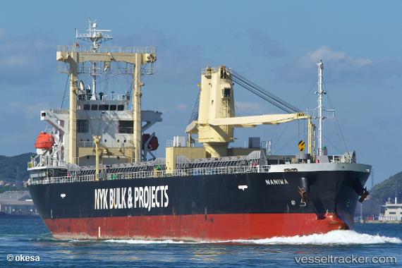
Naniwa
Current StatusWhere is the vessel?
Naniwa is currently in Near Gobo Wakayama, based on AIS data received less than 1h ago.
Latest AIS update:
Current position: 33.86606° N, 135.15498° E (Near Gobo Wakayama)
Average speed (last 7 days): Loading…
Average speed (last 30 days): Loading…
Vessel profile: Naniwa is a General Cargo Ship with dimensions 19m x 131m.
This page combines live AIS, route history, probable destination signals, nearby traffic, and port activity for practical vessel monitoring.
The current position of vessel Naniwa is 33.86606 lat / 135.15498 lng. Updated: 2026-04-29 16:30:58 UTCNearest reference points:
- 12 nm S of Gobo Wakayama
- Near SHIMOTSU
- 18 nm SE of Gobo Wakayama
Details:
Live Vessel Naniwa Analytics (details, animations, etc.)
Recent AIS points (UTC):
2026-04-29 11:57:58 UTC · 33.86607, 135.15500 · SOG 0.1 kn · COG 248°2026-04-29 13:33:59 UTC · 33.86608, 135.15500 · SOG 0.1 kn · COG 248°
2026-04-29 16:12:58 UTC · 33.86608, 135.15501 · SOG 0 kn · COG 248°
2026-04-29 16:30:58 UTC · 33.86606, 135.15498 · SOG 0 kn · COG 248°