 vesseltracker.com
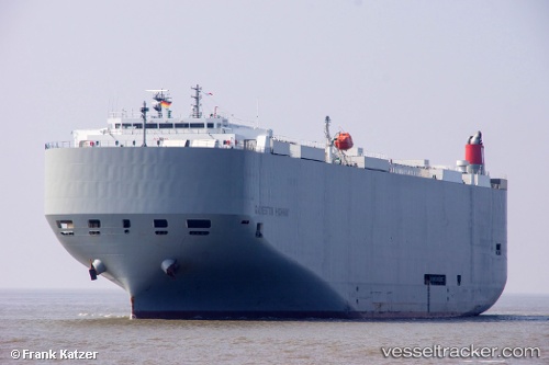
 Galveston Highway
Current Status
Where is the vessel?
Galveston Highway is currently in 352 nm SW of Santa Rosa Island, based on AIS data received about 2h ago.
Latest AIS update:
Current position: 28.62340° N, 122.95835° W (352 nm SW of Santa Rosa Island)
Average speed (last 7 days): Loading…
Average speed (last 30 days): Loading…
Vessel profile: Galveston Highway is a Vehicles Carrier with dimensions 199m x 32m.
This page combines live AIS, route history, probable destination signals, nearby traffic, and port activity for practical vessel monitoring.
The current position of vessel Galveston Highway is 28.62340 lat / -122.95835 lng. Updated: 2026-05-02 20:02:12 UTCNearest reference points:
- Open sea, approx. 407 nm off the nearest listed port
- Open sea, approx. 406 nm off the nearest listed port
- Open sea, approx. 412 nm off the nearest listed port
Currently sailing under the flag of Panama ![]()
Details:
Live Vessel Galveston Highway Analytics (details, animations, etc.)
Recent AIS points (UTC):
2026-05-02 16:23:13 UTC · 29.00401, -123.94270 · SOG 15.4 kn · COG 116°2026-05-02 18:08:38 UTC · 28.81276, -123.47585 · SOG 15.8 kn · COG 110°
2026-05-02 19:42:24 UTC · 28.65733, -123.04662 · SOG 15.4 kn · COG 112°
2026-05-02 20:02:12 UTC · 28.62340, -122.95835 · SOG 15.3 kn · COG 117°