 vesseltracker.com
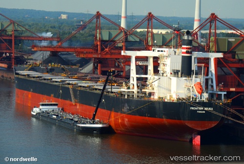
Frontier Asuka
Current StatusWhere is the vessel?
Frontier Asuka is currently in Near FUKUYAMA, based on AIS data received about 1h ago.
Latest AIS update:
Current position: 34.45478° N, 133.44576° E (Near FUKUYAMA)
Average speed (last 7 days): Loading…
Average speed (last 30 days): Loading…
Vessel profile: Frontier Asuka is a Bulk Carrier with dimensions 45m x 292m.
This page combines live AIS, route history, probable destination signals, nearby traffic, and port activity for practical vessel monitoring.
The current position of vessel Frontier Asuka is 34.45478 lat / 133.44576 lng. Updated: 2026-05-13 04:48:18 UTCNearest reference points:
- Near FUKUYAMA
- Near MIZUSHIMA
- Near Kurashiki
Details:
Live Vessel Frontier Asuka Analytics (details, animations, etc.)
Recent AIS points (UTC):
2026-05-13 01:33:18 UTC · 34.45473, 133.44579 · SOG 0.1 kn · COG 180°2026-05-13 01:39:18 UTC · 34.45482, 133.44582 · SOG 0.1 kn · COG 180°
2026-05-13 04:03:18 UTC · 34.45474, 133.44576 · SOG 0.1 kn · COG 180°
2026-05-13 04:48:18 UTC · 34.45478, 133.44576 · SOG 0 kn · COG 180°