 vesseltracker.com
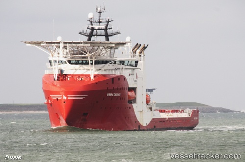
 SIEM STINGRAY
Current Status
Where is the vessel?
SIEM STINGRAY is currently in Near Hundvaag, based on AIS data received about 1h ago.
Latest AIS update:
Current position: 59.01183° N, 5.69342° E (Near Hundvaag)
Average speed (last 7 days): Loading…
Average speed (last 30 days): Loading…
Vessel profile: SIEM STINGRAY is a Other Type with dimensions m x m.
This page combines live AIS, route history, probable destination signals, nearby traffic, and port activity for practical vessel monitoring.
The current position of vessel SIEM STINGRAY is 59.01183 lat / 5.69342 lng. Updated: 2026-05-14 05:45:44 UTCNearest reference points:
- Near Lura
- Near HUSOYA
- Near Storøya
Currently sailing under the flag of Bahamas ![]()
Details:
Live Vessel SIEM STINGRAY Analytics (details, animations, etc.)
Recent AIS points (UTC):
2026-05-14 01:29:56 UTC · 59.02369, 5.61823 · SOG 0 kn · COG 126°2026-05-14 03:41:53 UTC · 59.02368, 5.61822 · SOG 0.1 kn · COG 126°
2026-05-14 04:34:43 UTC · 59.01135, 5.69090 · SOG 2.9 kn · COG 86°
2026-05-14 05:45:44 UTC · 59.01183, 5.69342 · SOG 0.1 kn · COG 318°