 vesseltracker.com
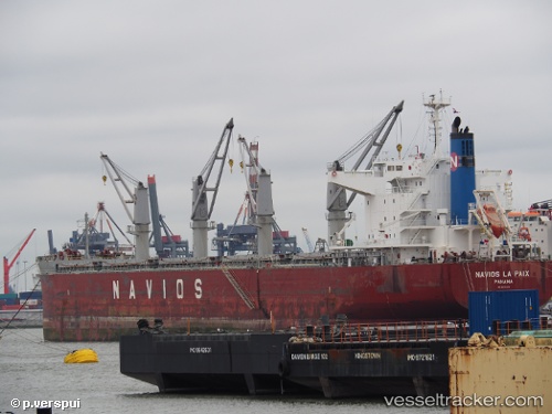
 NAVIOS LA PAIX
Current Status
Where is the vessel?
NAVIOS LA PAIX is currently in 71 nm N of San Juan, based on AIS data received less than 1h ago.
Latest AIS update:
Current position: 19.62100° N, 65.89266° W (71 nm N of San Juan)
Average speed (last 7 days): Loading…
Average speed (last 30 days): Loading…
Vessel profile: NAVIOS LA PAIX is a Bulk Carrier with dimensions m x m.
This page combines live AIS, route history, probable destination signals, nearby traffic, and port activity for practical vessel monitoring.
The current position of vessel NAVIOS LA PAIX is 19.62100 lat / -65.89266 lng. Updated: 2026-05-16 11:28:44 UTCNearest reference points:
- 24 nm N of CULEBRA
- Near San Juan
- Near Roosevelt Roads
Currently sailing under the flag of Malta ![]()
Details:
Live Vessel NAVIOS LA PAIX Analytics (details, animations, etc.)
Recent AIS points (UTC):
2026-05-16 08:17:51 UTC · 19.64833, -66.49667 · SOG 10 kn · COG -1°2026-05-16 09:49:53 UTC · 19.63255, -66.20753 · SOG 10.7 kn · COG 94°
2026-05-16 10:49:13 UTC · 19.62532, -66.01829 · SOG 10.8 kn · COG 94°
2026-05-16 11:28:44 UTC · 19.62100, -65.89266 · SOG 10.7 kn · COG 95°