 vesseltracker.com
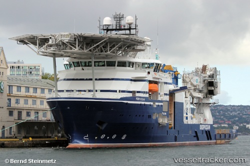
 Normand Ocean
Current Status
Where is the vessel?
Normand Ocean is currently in 67 nm N of Alve, based on AIS data received about 1h ago.
Latest AIS update:
Current position: 67.06500° N, 7.09500° E (67 nm N of Alve)
Average speed (last 7 days): Loading…
Average speed (last 30 days): Loading…
Vessel profile: Normand Ocean is a Offshore Support Vessel with dimensions 107m x 22m.
This page combines live AIS, route history, probable destination signals, nearby traffic, and port activity for practical vessel monitoring.
The current position of vessel Normand Ocean is 67.06500 lat / 7.09500 lng. Updated: 2026-05-15 05:45:23 UTCCurrently sailing under the flag of Norway ![]()
Normand Ocean built in 2014 year
Deadweight:
5520 tDetails:
Live Vessel Normand Ocean Analytics (details, animations, etc.)
Recent AIS points (UTC):
2026-05-15 01:09:20 UTC · 67.06333, 7.09333 · SOG 0 kn · COG -1°2026-05-15 03:39:20 UTC · 67.06500, 7.09500 · SOG 0 kn · COG -1°
2026-05-15 03:39:20 UTC · 67.06500, 7.09500 · SOG 0 kn · COG -1°
2026-05-15 05:45:23 UTC · 67.06500, 7.09500 · SOG 0 kn · COG -1°