 vesseltracker.com
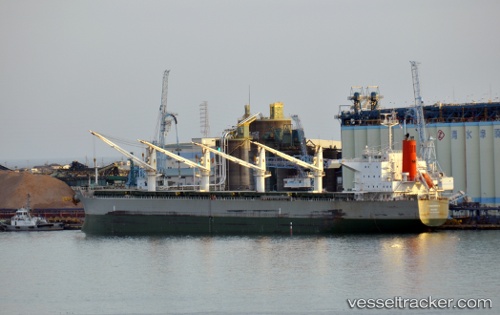
 PORTO KIONI
Current Status
Where is the vessel?
PORTO KIONI is currently in 56 nm S of Mosselbaai, based on AIS data received less than 1h ago.
Latest AIS update:
Current position: 35.05649° S, 22.48626° E (56 nm S of Mosselbaai)
Average speed (last 7 days): Loading…
Average speed (last 30 days): Loading…
Vessel profile: PORTO KIONI is a Bulk Carrier with dimensions m x m.
This page combines live AIS, route history, probable destination signals, nearby traffic, and port activity for practical vessel monitoring.
The current position of vessel PORTO KIONI is -35.05649 lat / 22.48626 lng. Updated: 2026-05-13 21:25:40 UTCNearest reference points:
- 37 nm S of Mosselbaai
- 16 nm S of Mosselbaai
- Near Mosselbaai
Currently sailing under the flag of Panama ![]()
Details:
Live Vessel PORTO KIONI Analytics (details, animations, etc.)
Recent AIS points (UTC):
2026-05-13 18:18:04 UTC · -35.12059, 21.87806 · SOG 10.4 kn · COG 92°2026-05-13 19:16:16 UTC · -35.11987, 22.06860 · SOG 9.6 kn · COG 79°
2026-05-13 20:15:32 UTC · -35.09284, 22.27079 · SOG 10.5 kn · COG 79°
2026-05-13 21:25:40 UTC · -35.05649, 22.48626 · SOG 8.8 kn · COG 75°