 vesseltracker.com
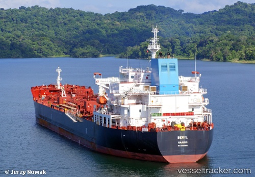
 Beryl
Beryl
Current Status
Where is the vessel?
Beryl is currently in 50 nm SW of Baco, based on AIS data received about 4h ago.
Latest AIS update:
Current position: 7.44884° N, 83.43388° W (50 nm SW of Baco)
Average speed (last 7 days): Loading…
Average speed (last 30 days): Loading…
Vessel profile: Beryl is a Chemical Oil Products Tanker with dimensions 183m x 183m.
This page combines live AIS, route history, probable destination signals, nearby traffic, and port activity for practical vessel monitoring.
The current position of vessel Beryl is 7.44884 lat / -83.43388 lng. Updated: 2026-05-14 23:21:50 UTCNearest reference points:
- Near Chiriquí Grande
- 20 nm S of El Puerto
Currently sailing under the flag of Marshall Is ![]()
Details:
Live Vessel Beryl Analytics (details, animations, etc.)
Recent AIS points (UTC):
2026-05-14 19:36:24 UTC · 7.18665, -82.63019 · SOG 13.8 kn · COG 289°2026-05-14 21:40:19 UTC · 7.33352, -83.07653 · SOG 13.2 kn · COG 286°
2026-05-14 23:07:42 UTC · 7.43395, -83.38300 · SOG 13.3 kn · COG 287°
2026-05-14 23:21:50 UTC · 7.44884, -83.43388 · SOG 13.3 kn · COG 287°