 vesseltracker.com
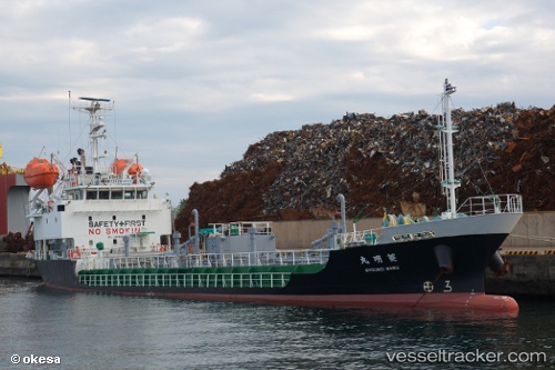
 Ryoumeimaru
Current Status
Where is the vessel?
Ryoumeimaru is currently in Near Izumiotsu, based on AIS data received less than 1h ago.
Latest AIS update:
Current position: 34.51065° N, 135.38467° E (Near Izumiotsu)
Average speed (last 7 days): Loading…
Average speed (last 30 days): Loading…
Vessel profile: Ryoumeimaru is a Bitumen Tanker with dimensions 69m x 11m.
This page combines live AIS, route history, probable destination signals, nearby traffic, and port activity for practical vessel monitoring.
The current position of vessel Ryoumeimaru is 34.51065 lat / 135.38467 lng. Updated: 2026-05-15 18:01:13 UTCNearest reference points:
- Near SAKAI
- Near Nada-Ku, Hyogo
- Near Kobe
Currently sailing under the flag of Japan ![]()
Details:
Live Vessel Ryoumeimaru Analytics (details, animations, etc.)
Recent AIS points (UTC):
2026-05-15 14:24:55 UTC · 34.51065, 135.38466 · SOG 0 kn · COG 25°2026-05-15 15:48:57 UTC · 34.51063, 135.38466 · SOG 0 kn · COG 25°
2026-05-15 16:57:58 UTC · 34.51066, 135.38464 · SOG 0 kn · COG 25°
2026-05-15 18:01:13 UTC · 34.51065, 135.38467 · SOG 0 kn · COG 25°