 vesseltracker.com
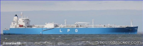
 Albert
Current Status
Where is the vessel?
Albert is currently in 171 nm E of Tampico, based on AIS data received about 2h ago.
Latest AIS update:
Current position: 22.41007° N, 93.98980° W (171 nm E of Tampico)
Average speed (last 7 days): Loading…
Average speed (last 30 days): Loading…
Vessel profile: Albert is a Lpg Tanker with dimensions 225m x 36m.
This page combines live AIS, route history, probable destination signals, nearby traffic, and port activity for practical vessel monitoring.
The current position of vessel Albert is 22.41007 lat / -93.98980 lng. Updated: 2026-04-29 11:45:59 UTCCurrently sailing under the flag of Panama ![]()
Details:
Live Vessel Albert Analytics (details, animations, etc.)
Recent AIS points (UTC):
2026-04-29 07:44:22 UTC · 21.39206, -94.19998 · SOG 14.1 kn · COG 9°2026-04-29 10:22:02 UTC · 22.05028, -94.06934 · SOG 15.6 kn · COG 14°
2026-04-29 10:22:14 UTC · 22.05070, -94.06924 · SOG 15.6 kn · COG 14°
2026-04-29 11:45:59 UTC · 22.41007, -93.98980 · SOG 15.6 kn · COG 14°