 vesseltracker.com
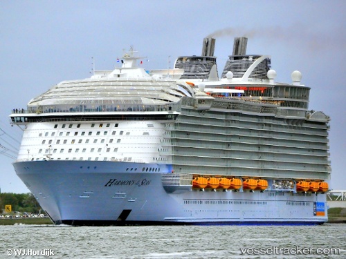
 Harmony Of The Seas
Current Status
Where is the vessel?
Harmony Of The Seas is currently in Near Cadiz, based on AIS data received about 2h ago.
Latest AIS update:
Current position: 36.52795° N, 6.28013° W (Near Cadiz)
Average speed (last 7 days): Loading…
Average speed (last 30 days): Loading…
Vessel profile: Harmony Of The Seas is a Cruise Ship with dimensions 362m x 66m.
This page combines live AIS, route history, probable destination signals, nearby traffic, and port activity for practical vessel monitoring.
The current position of vessel Harmony Of The Seas is 36.52795 lat / -6.28013 lng. Updated: 2026-05-13 19:36:36 UTCNearest reference points:
- Near Cadiz
- Near El Puerto de Santa María
- Near CHIPIONA
Currently sailing under the flag of Bahamas ![]()
Details:
Live Vessel Harmony Of The Seas Analytics (details, animations, etc.)
Recent AIS points (UTC):
2026-05-13 16:27:37 UTC · 36.52795, -6.28001 · SOG 0 kn · COG 282°2026-05-13 18:06:36 UTC · 36.52794, -6.28001 · SOG 0 kn · COG 282°
2026-05-13 19:03:36 UTC · 36.52794, -6.28001 · SOG 0 kn · COG 282°
2026-05-13 19:36:36 UTC · 36.52795, -6.28013 · SOG 0 kn · COG 282°