 vesseltracker.com
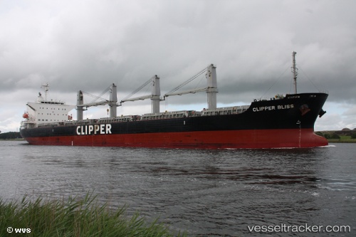
 SEA BLISS
Current Status
Where is the vessel?
SEA BLISS is currently in 130 nm NE of Kitadaito Apt, based on AIS data received about 14h ago.
Latest AIS update:
Current position: 27.17890° N, 133.27190° E (130 nm NE of Kitadaito Apt)
Average speed (last 7 days): Loading…
Average speed (last 30 days): Loading…
Vessel profile: SEA BLISS is a Bulk Carrier with dimensions 30m x 180m.
This page combines live AIS, route history, probable destination signals, nearby traffic, and port activity for practical vessel monitoring.
The current position of vessel SEA BLISS is 27.17890 lat / 133.27190 lng. Updated: 2026-04-21 22:25:12 UTCNearest reference points:
- 107 nm NE of Kitadaito Apt
Currently sailing under the flag of Singapore ![]()
SEA BLISS built in 2014 year
Deadweight:
38147 tDetails:
Live Vessel SEA BLISS Analytics (details, animations, etc.)
Recent AIS points (UTC):
2026-04-21 22:25:12 UTC · 27.17890, 133.27190 · SOG 13 kn · COG 320°2026-04-21 22:25:12 UTC · 27.17890, 133.27190 · SOG 13 kn · COG 320°
2026-04-21 22:25:12 UTC · 27.17890, 133.27190 · SOG 13 kn · COG 320°
2026-04-21 22:25:12 UTC · 27.17890, 133.27190 · SOG 13 kn · COG 320°