 vesseltracker.com
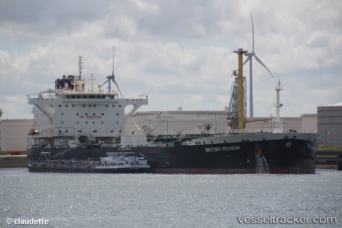
 British Reason
Current Status
Where is the vessel?
British Reason is currently in 13 nm NW of Northmavine, based on AIS data received less than 1h ago.
Latest AIS update:
Current position: 60.76833° N, 1.66769° W (13 nm NW of Northmavine)
Average speed (last 7 days): Loading…
Average speed (last 30 days): Loading…
Vessel profile: British Reason is a Crude Oil Tanker with dimensions 250m x 44m.
This page combines live AIS, route history, probable destination signals, nearby traffic, and port activity for practical vessel monitoring.
The current position of vessel British Reason is 60.76833 lat / -1.66769 lng. Updated: 2026-05-01 22:31:52 UTCNearest reference points:
- 32 nm NW of Eshaness
- 36 nm NW of Ham Voe, Foula
- Near Tingwall
Currently sailing under the flag of United Kingdom ![]()
Details:
Live Vessel British Reason Analytics (details, animations, etc.)
Recent AIS points (UTC):
2026-05-01 12:53:07 UTC · 60.45613, -1.29385 · SOG 0 kn · COG 317°2026-05-01 19:56:13 UTC · 60.47326, -1.31087 · SOG 6.1 kn · COG 20°
2026-05-01 22:10:52 UTC · 60.75613, -1.52352 · SOG 11.9 kn · COG 280°
2026-05-01 22:31:52 UTC · 60.76833, -1.66769 · SOG 12.3 kn · COG 280°