 vesseltracker.com
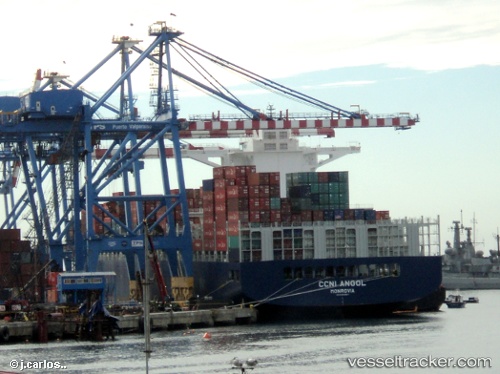
 Ccni Angol
Current Status
Where is the vessel?
Ccni Angol is currently in 277 nm SE of Ascension, based on AIS data received less than 1h ago.
Latest AIS update:
Current position: 11.71167° S, 11.64833° W (277 nm SE of Ascension)
Average speed (last 7 days): Loading…
Average speed (last 30 days): Loading…
Vessel profile: Ccni Angol is a Container Ship with dimensions 300m x 300m.
This page combines live AIS, route history, probable destination signals, nearby traffic, and port activity for practical vessel monitoring.
The current position of vessel Ccni Angol is -11.71167 lat / -11.64833 lng. Updated: 2026-05-16 12:09:14 UTCCurrently sailing under the flag of Liberia ![]()
Details:
Live Vessel Ccni Angol Analytics (details, animations, etc.)
Recent AIS points (UTC):
2026-05-16 07:42:18 UTC · -10.84500, -12.50833 · SOG 16 kn · COG -1°2026-05-16 09:36:15 UTC · -11.21167, -12.14667 · SOG 16 kn · COG -1°
2026-05-16 09:36:15 UTC · -11.21167, -12.14667 · SOG 16 kn · COG -1°
2026-05-16 12:09:14 UTC · -11.71167, -11.64833 · SOG 16 kn · COG -1°