 vesseltracker.com
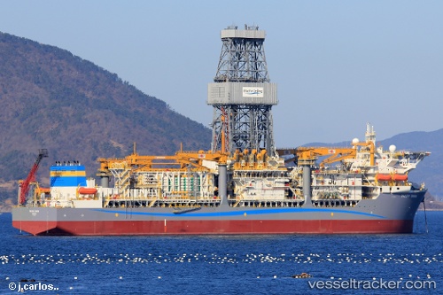
 ATLANTIC ZONDA
Current Status
Where is the vessel?
ATLANTIC ZONDA is currently in 54 nm N of Cidade de Angra dos Reis FPSO, based on AIS data received less than 1h ago.
Latest AIS update:
Current position: 24.69148° S, 42.48507° W (54 nm N of Cidade de Angra dos Reis FPSO)
Average speed (last 7 days): Loading…
Average speed (last 30 days): Loading…
Vessel profile: ATLANTIC ZONDA is a Other Type with dimensions m x m.
This page combines live AIS, route history, probable destination signals, nearby traffic, and port activity for practical vessel monitoring.
The current position of vessel ATLANTIC ZONDA is -24.69148 lat / -42.48507 lng. Updated: 2026-05-13 19:56:28 UTCNearest reference points:
- 69 nm NE of Cidade de Angra dos Reis FPSO
- 34 nm S of Cidade de Angra dos Reis FPSO
- 49 nm S of SEPETIBA
Currently sailing under the flag of Liberia ![]()
Details:
Live Vessel ATLANTIC ZONDA Analytics (details, animations, etc.)
Recent AIS points (UTC):
2026-05-13 16:38:52 UTC · -24.69149, -42.48509 · SOG 0.3 kn · COG 205°2026-05-13 18:13:45 UTC · -24.69144, -42.48506 · SOG 0.2 kn · COG 205°
2026-05-13 19:08:09 UTC · -24.69147, -42.48507 · SOG 0.2 kn · COG 205°
2026-05-13 19:56:28 UTC · -24.69148, -42.48507 · SOG 0.2 kn · COG 205°