 vesseltracker.com
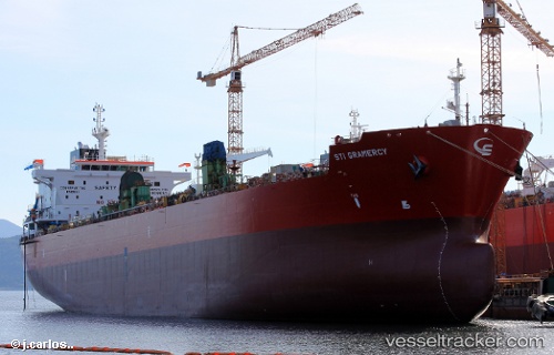
Sti Gramercy
Current StatusWhere is the vessel?
Sti Gramercy is currently in Near Umhlanga Rocks, based on AIS data received less than 1h ago.
Latest AIS update:
Current position: 29.76355° S, 31.17364° E (Near Umhlanga Rocks)
Average speed (last 7 days): Loading…
Average speed (last 30 days): Loading…
Vessel profile: Sti Gramercy is a Chemical Oil Products Tanker with dimensions 32m x 183m.
This page combines live AIS, route history, probable destination signals, nearby traffic, and port activity for practical vessel monitoring.
The current position of vessel Sti Gramercy is -29.76355 lat / 31.17364 lng. Updated: 2026-05-15 14:02:52 UTCNearest reference points:
- Near Umhlanga Rocks
- Near Durban
- Near Island View
Details:
Live Vessel Sti Gramercy Analytics (details, animations, etc.)
Recent AIS points (UTC):
2026-05-15 10:26:53 UTC · -29.76380, 31.17358 · SOG 0.1 kn · COG 182°2026-05-15 11:38:53 UTC · -29.76374, 31.17419 · SOG 0.2 kn · COG 205°
2026-05-15 13:38:52 UTC · -29.76360, 31.17365 · SOG 0.1 kn · COG 179°
2026-05-15 14:02:52 UTC · -29.76355, 31.17364 · SOG 0 kn · COG 182°