 vesseltracker.com
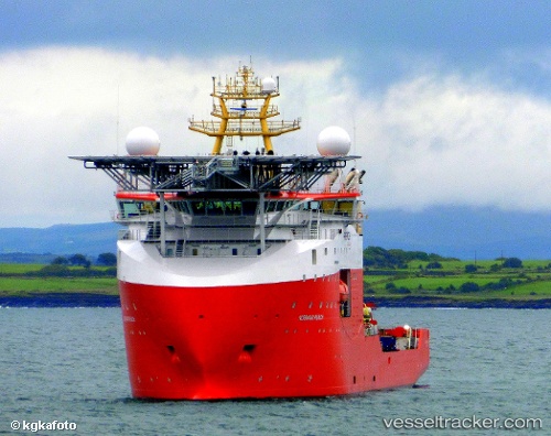
Normand Reach
Current StatusWhere is the vessel?
Normand Reach is currently in Near Macaé, based on AIS data received less than 1h ago.
Latest AIS update:
Current position: 22.33194° S, 41.67466° W (Near Macaé)
Average speed (last 7 days): Loading…
Average speed (last 30 days): Loading…
Vessel profile: Normand Reach is a Offshore Support Vessel with dimensions 23m x 121m.
This page combines live AIS, route history, probable destination signals, nearby traffic, and port activity for practical vessel monitoring.
The current position of vessel Normand Reach is -22.33194 lat / -41.67466 lng. Updated: 2026-05-14 03:36:53 UTCNearest reference points:
- 24 nm SE of Carapebus
- Near PORTO DO ACU
- 47 nm E of Arraial do Cabo
Details:
Live Vessel Normand Reach Analytics (details, animations, etc.)
Recent AIS points (UTC):
2026-05-13 23:38:15 UTC · -22.33176, -41.67437 · SOG 0.3 kn · COG 135°2026-05-14 02:03:52 UTC · -22.33192, -41.67456 · SOG 0.1 kn · COG 146°
2026-05-14 02:51:42 UTC · -22.33195, -41.67461 · SOG 0.1 kn · COG 145°
2026-05-14 03:36:53 UTC · -22.33194, -41.67466 · SOG 0.1 kn · COG 146°