 vesseltracker.com
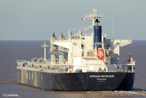
 AFRICAN BATELEUR
Current Status
Where is the vessel?
AFRICAN BATELEUR is currently in 94 nm N of Camar Marine Terminal, based on AIS data received less than 1h ago.
Latest AIS update:
Current position: 4.75809° S, 113.25531° E (94 nm N of Camar Marine Terminal)
Average speed (last 7 days): Loading…
Average speed (last 30 days): Loading…
Vessel profile: AFRICAN BATELEUR is a Cargo with dimensions m x m.
This page combines live AIS, route history, probable destination signals, nearby traffic, and port activity for practical vessel monitoring.
The current position of vessel AFRICAN BATELEUR is -4.75809 lat / 113.25531 lng. Updated: 2026-05-14 04:41:44 UTCNearest reference points:
- 50 nm N of Camar Marine Terminal
- 60 nm NW of Camar Marine Terminal
- 27 nm NE of Camar Marine Terminal
Currently sailing under the flag of Bahamas ![]()
Details:
Live Vessel AFRICAN BATELEUR Analytics (details, animations, etc.)
Recent AIS points (UTC):
2026-05-13 22:12:20 UTC · -4.69376, 114.73120 · SOG 13.3 kn · COG 265°2026-05-13 22:12:20 UTC · -4.69376, 114.73120 · SOG 13.3 kn · COG 265°
2026-05-13 22:12:20 UTC · -4.69376, 114.73120 · SOG 13.3 kn · COG 265°
2026-05-14 04:41:44 UTC · -4.75809, 113.25531 · SOG 14 kn · COG 270°