 vesseltracker.com
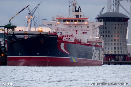
 HAFNIA ANDREA
Current Status
Where is the vessel?
HAFNIA ANDREA is currently in Near Texas City, based on AIS data received less than 1h ago.
Latest AIS update:
Current position: 29.37024° N, 94.88917° W (Near Texas City)
Average speed (last 7 days): Loading…
Average speed (last 30 days): Loading…
Vessel profile: HAFNIA ANDREA is a Chemical/Oil Products Tanker with dimensions 32m x 183m.
This page combines live AIS, route history, probable destination signals, nearby traffic, and port activity for practical vessel monitoring.
The current position of vessel HAFNIA ANDREA is 29.37024 lat / -94.88917 lng. Updated: 2026-05-13 19:27:47 UTCNearest reference points:
- Near Texas City
- Near Port Bolivar
- Near Clear Lake Shores
Currently sailing under the flag of Singapore ![]()
HAFNIA ANDREA built in 2015 year
Deadweight:
49999 tDetails:
Live Vessel HAFNIA ANDREA Analytics (details, animations, etc.)
Recent AIS points (UTC):
2026-05-13 16:09:50 UTC · 29.37023, -94.88917 · SOG 0 kn · COG -1°2026-05-13 16:57:50 UTC · 29.37025, -94.88919 · SOG 0 kn · COG 24°
2026-05-13 18:00:50 UTC · 29.37025, -94.88921 · SOG 0 kn · COG 357°
2026-05-13 19:27:47 UTC · 29.37024, -94.88917 · SOG 0 kn · COG 356°