 vesseltracker.com
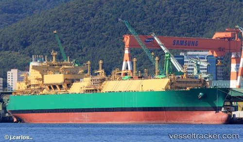
Lng Abuja Ii
Current StatusWhere is the vessel?
Lng Abuja Ii is currently in Near BUKOM ISLAND, based on AIS data received less than 1h ago.
Latest AIS update:
Current position: 1.15915° N, 103.72979° E (Near BUKOM ISLAND)
Average speed (last 7 days): Loading…
Average speed (last 30 days): Loading…
Vessel profile: Lng Abuja Ii is a Lng Tanker with dimensions 48m x 292m.
This page combines live AIS, route history, probable destination signals, nearby traffic, and port activity for practical vessel monitoring.
The current position of vessel Lng Abuja Ii is 1.15915 lat / 103.72979 lng. Updated: 2026-05-14 22:29:04 UTCNearest reference points:
- Near BUKOM ISLAND
- Near JURONG ISLAND
- Near Pulau Ayer Chawan
Details:
Live Vessel Lng Abuja Ii Analytics (details, animations, etc.)
Recent AIS points (UTC):
2026-05-14 19:14:05 UTC · 1.15694, 103.73397 · SOG 0 kn · COG 287°2026-05-14 20:14:04 UTC · 1.15775, 103.73400 · SOG 0.1 kn · COG 269°
2026-05-14 22:11:04 UTC · 1.15951, 103.73001 · SOG 0.4 kn · COG 149°
2026-05-14 22:29:04 UTC · 1.15915, 103.72979 · SOG 0.1 kn · COG 125°