 vesseltracker.com
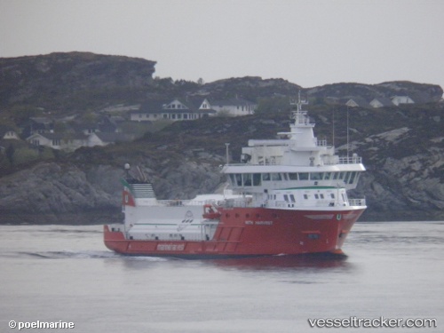
 With Harvest
Current Status
Where is the vessel?
With Harvest is currently in Near Nordskaget - Frøya, based on AIS data received less than 1h ago.
Latest AIS update:
Current position: 63.59583° N, 8.51247° E (Near Nordskaget - Frøya)
Average speed (last 7 days): Loading…
Average speed (last 30 days): Loading…
Vessel profile: With Harvest is a Multi Purpose Carrier with dimensions 70m x 23m.
This page combines live AIS, route history, probable destination signals, nearby traffic, and port activity for practical vessel monitoring.
The current position of vessel With Harvest is 63.59583 lat / 8.51247 lng. Updated: 2026-05-02 21:45:56 UTCNearest reference points:
- Near Stranda - Frøya
- Near Dolmøy
- Near Siholmen
Currently sailing under the flag of Norway ![]()
Details:
Live Vessel With Harvest Analytics (details, animations, etc.)
Recent AIS points (UTC):
2026-05-02 18:18:17 UTC · 63.39510, 8.20882 · SOG 0 kn · COG 237°2026-05-02 19:29:47 UTC · 63.52619, 8.22855 · SOG 11.3 kn · COG 16°
2026-05-02 19:56:37 UTC · 63.60443, 8.29567 · SOG 10.8 kn · COG 54°
2026-05-02 21:45:56 UTC · 63.59583, 8.51247 · SOG 0 kn · COG 35°