 vesseltracker.com
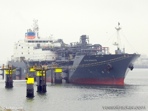
 Zita Schulte
Current Status
Where is the vessel?
Zita Schulte is currently in 100 nm SE of Baye, based on AIS data received less than 1h ago.
Latest AIS update:
Current position: 47.81667° N, 33.08500° W (100 nm SE of Baye)
Average speed (last 7 days): Loading…
Average speed (last 30 days): Loading…
Vessel profile: Zita Schulte is a Lpg Tanker with dimensions 146m x 23m.
This page combines live AIS, route history, probable destination signals, nearby traffic, and port activity for practical vessel monitoring.
The current position of vessel Zita Schulte is 47.81667 lat / -33.08500 lng. Updated: 2026-05-02 16:10:24 UTCCurrently sailing under the flag of United Kingdom ![]()
Details:
Live Vessel Zita Schulte Analytics (details, animations, etc.)
Recent AIS points (UTC):
2026-05-02 13:09:11 UTC · 48.18989, -32.33317 · SOG 12.6 kn · COG 235°2026-05-02 13:49:24 UTC · 48.10833, -32.50333 · SOG 12 kn · COG -1°
2026-05-02 16:01:23 UTC · 47.83667, -33.04667 · SOG 12 kn · COG -1°
2026-05-02 16:10:24 UTC · 47.81667, -33.08500 · SOG 13 kn · COG -1°