 vesseltracker.com
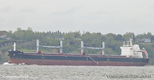
Iolaos
Current StatusWhere is the vessel?
Iolaos is currently in 10 nm SE of Daxie Pt, based on AIS data received less than 1h ago.
Latest AIS update:
Current position: 29.78848° N, 122.11533° E (10 nm SE of Daxie Pt)
Average speed (last 7 days): Loading…
Average speed (last 30 days): Loading…
Vessel profile: Iolaos is a Bulk Carrier with dimensions 32m x 200m.
This page combines live AIS, route history, probable destination signals, nearby traffic, and port activity for practical vessel monitoring.
The current position of vessel Iolaos is 29.78848 lat / 122.11533 lng. Updated: 2026-05-14 03:25:15 UTCNearest reference points:
- 10 nm SE of Daxie Pt
- Near Daxie Pt
- Near ZHOUSHAN
Details:
Live Vessel Iolaos Analytics (details, animations, etc.)
Recent AIS points (UTC):
2026-05-10 06:11:27 UTC · 29.79123, 122.11107 · SOG 0 kn · COG -1°2026-05-10 06:11:27 UTC · 29.79123, 122.11107 · SOG 0 kn · COG -1°
2026-05-10 06:11:27 UTC · 29.79123, 122.11107 · SOG 0 kn · COG -1°
2026-05-14 03:25:15 UTC · 29.78848, 122.11533 · SOG 0 kn · COG -1°