 vesseltracker.com
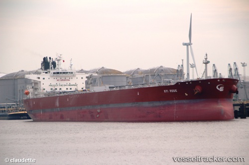
 Sti Rose
Current Status
Where is the vessel?
Sti Rose is currently in 245 nm S of Benahavis, based on AIS data received less than 1h ago.
Latest AIS update:
Current position: 32.46592° N, 51.04178° W (245 nm S of Benahavis)
Average speed (last 7 days): Loading…
Average speed (last 30 days): Loading…
Vessel profile: Sti Rose is a Crude Oil Tanker with dimensions 256m x 256m.
This page combines live AIS, route history, probable destination signals, nearby traffic, and port activity for practical vessel monitoring.
The current position of vessel Sti Rose is 32.46592 lat / -51.04178 lng. Updated: 2026-05-14 21:21:21 UTCNearest reference points:
- 244 nm SW of Benahavis
Currently sailing under the flag of Marshall Is ![]()
Details:
Live Vessel Sti Rose Analytics (details, animations, etc.)
Recent AIS points (UTC):
2026-05-14 17:26:33 UTC · 32.30151, -51.98291 · SOG 12.8 kn · COG 80°2026-05-14 19:17:19 UTC · 32.38208, -51.53213 · SOG 12.5 kn · COG 76°
2026-05-14 20:03:58 UTC · 32.41718, -51.34844 · SOG 12.3 kn · COG 81°
2026-05-14 21:21:21 UTC · 32.46592, -51.04178 · SOG 12.3 kn · COG 76°