 vesseltracker.com
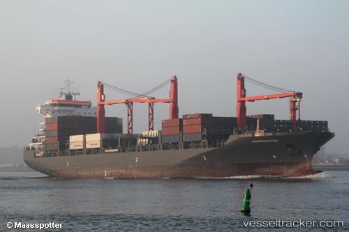
 MAERSK BAHAMAS
Current Status
Where is the vessel?
MAERSK BAHAMAS is currently in 140 nm NW of Bolinao, based on AIS data received less than 1h ago.
Latest AIS update:
Current position: 17.80333° N, 117.94333° E (140 nm NW of Bolinao)
Average speed (last 7 days): Loading…
Average speed (last 30 days): Loading…
Vessel profile: MAERSK BAHAMAS is a Container Ship with dimensions 32m x 195m.
This page combines live AIS, route history, probable destination signals, nearby traffic, and port activity for practical vessel monitoring.
The current position of vessel MAERSK BAHAMAS is 17.80333 lat / 117.94333 lng. Updated: 2026-04-28 09:52:42 UTCNearest reference points:
- 138 nm NW of Bolinao
- 22 nm W of Salomague
- 148 nm SE of Xijiang
Currently sailing under the flag of Singapore ![]()
MAERSK BAHAMAS built in 2016 year
Deadweight:
35225 tDetails:
Live Vessel MAERSK BAHAMAS Analytics (details, animations, etc.)
Recent AIS points (UTC):
2026-04-28 05:55:42 UTC · 18.61333, 117.44333 · SOG 13 kn · COG -1°2026-04-28 07:22:44 UTC · 18.31833, 117.62333 · SOG 13 kn · COG -1°
2026-04-28 08:04:43 UTC · 18.17333, 117.70333 · SOG 14 kn · COG -1°
2026-04-28 09:52:42 UTC · 17.80333, 117.94333 · SOG 14 kn · COG -1°