 vesseltracker.com
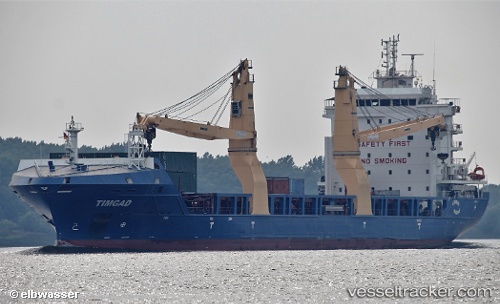
Timgad
Current StatusWhere is the vessel?
Timgad is currently in 90 nm W of Essaouira, based on AIS data received about 2h ago.
Latest AIS update:
Current position: 31.37500° N, 11.24667° W (90 nm W of Essaouira)
Average speed (last 7 days): Loading…
Average speed (last 30 days): Loading…
Vessel profile: Timgad is a Multi Purpose Carrier with dimensions 21m x 147m.
This page combines live AIS, route history, probable destination signals, nearby traffic, and port activity for practical vessel monitoring.
The current position of vessel Timgad is 31.37500 lat / -11.24667 lng. Updated: 2026-05-01 19:24:47 UTCNearest reference points:
- 64 nm W of Essaouira
- 87 nm W of Essaouira
- 120 nm W of Anza
Details:
Live Vessel Timgad Analytics (details, animations, etc.)
Recent AIS points (UTC):
2026-05-01 15:54:49 UTC · 30.80333, -11.75167 · SOG 12 kn · COG -1°2026-05-01 18:21:48 UTC · 31.20333, -11.39833 · SOG 12 kn · COG -1°
2026-05-01 19:12:49 UTC · 31.34167, -11.27500 · SOG 12 kn · COG -1°
2026-05-01 19:24:47 UTC · 31.37500, -11.24667 · SOG 11 kn · COG -1°