 vesseltracker.com
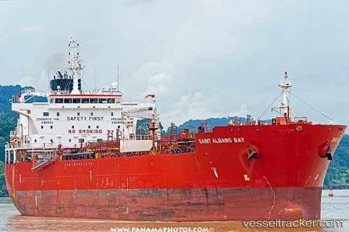
Saint Albans Bay
Current StatusWhere is the vessel?
Saint Albans Bay is currently in 16 nm SE of Port Bolivar, based on AIS data received less than 1h ago.
Latest AIS update:
Current position: 29.23761° N, 94.48136° W (16 nm SE of Port Bolivar)
Average speed (last 7 days): Loading…
Average speed (last 30 days): Loading…
Vessel profile: Saint Albans Bay is a Chemical Oil Products Tanker with dimensions 32m x 183m.
This page combines live AIS, route history, probable destination signals, nearby traffic, and port activity for practical vessel monitoring.
The current position of vessel Saint Albans Bay is 29.23761 lat / -94.48136 lng. Updated: 2026-05-14 17:34:56 UTCNearest reference points:
- 12 nm SE of Port Bolivar
- Near Port Bolivar
- 23 nm SW of Sabine Pass
Details:
Live Vessel Saint Albans Bay Analytics (details, animations, etc.)
Recent AIS points (UTC):
2026-05-14 13:24:49 UTC · 29.23972, -94.44148 · SOG 0 kn · COG 342°2026-05-14 16:00:48 UTC · 29.23978, -94.44200 · SOG 0 kn · COG 358°
2026-05-14 16:12:48 UTC · 29.23979, -94.44205 · SOG 0.1 kn · COG 359°
2026-05-14 17:34:56 UTC · 29.23761, -94.48136 · SOG 11.6 kn · COG 290°