 vesseltracker.com
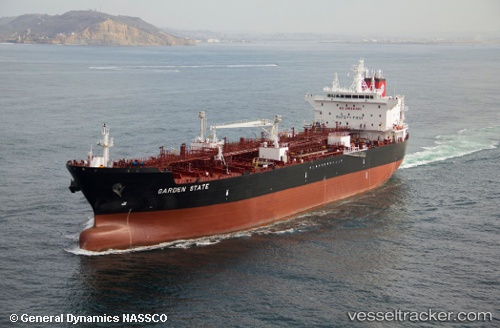
Garden State
Current StatusWhere is the vessel?
Garden State is currently in 12 nm S of Pascagoula, based on AIS data received less than 1h ago.
Latest AIS update:
Current position: 30.16370° N, 88.48547° W (12 nm S of Pascagoula)
Average speed (last 7 days): Loading…
Average speed (last 30 days): Loading…
Vessel profile: Garden State is a Chemical Oil Products Tanker with dimensions 32m x 186m.
This page combines live AIS, route history, probable destination signals, nearby traffic, and port activity for practical vessel monitoring.
The current position of vessel Garden State is 30.16370 lat / -88.48547 lng. Updated: 2026-05-14 16:17:43 UTCNearest reference points:
- Near Pascagoula
- Near BAYOU LA BATRE
- Near Ocean Springs
Details:
Live Vessel Garden State Analytics (details, animations, etc.)
Recent AIS points (UTC):
2026-05-14 11:27:25 UTC · 29.85618, -88.21079 · SOG 14.6 kn · COG 316°2026-05-14 13:27:33 UTC · 30.13663, -88.48578 · SOG 5.7 kn · COG 23°
2026-05-14 14:14:22 UTC · 30.16345, -88.48570 · SOG 0.1 kn · COG 304°
2026-05-14 16:17:43 UTC · 30.16370, -88.48547 · SOG 0 kn · COG 302°