 vesseltracker.com
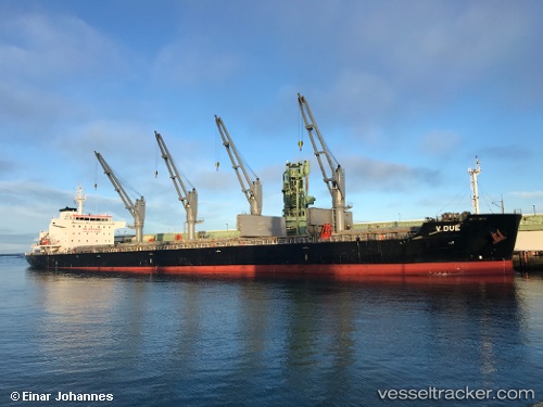
V Due
Current StatusWhere is the vessel?
V Due is currently in Near Sopot, based on AIS data received about 1h ago.
Latest AIS update:
Current position: 54.46267° N, 18.67066° E (Near Sopot)
Average speed (last 7 days): Loading…
Average speed (last 30 days): Loading…
Vessel profile: V Due is a Bulk Carrier with dimensions 30m x 181m.
This page combines live AIS, route history, probable destination signals, nearby traffic, and port activity for practical vessel monitoring.
The current position of vessel V Due is 54.46267 lat / 18.67066 lng. Updated: 2026-05-16 07:42:34 UTCNearest reference points:
- Near Sopot
- Near Nowy Port/Gdansk
- Near Gdynia
Details:
Live Vessel V Due Analytics (details, animations, etc.)
Recent AIS points (UTC):
2026-05-16 04:00:33 UTC · 54.46288, 18.67322 · SOG 0 kn · COG 323°2026-05-16 05:24:32 UTC · 54.46285, 18.67297 · SOG 0.1 kn · COG 324°
2026-05-16 07:27:34 UTC · 54.46266, 18.67181 · SOG 0.2 kn · COG 352°
2026-05-16 07:42:34 UTC · 54.46267, 18.67066 · SOG 0.2 kn · COG 20°