 vesseltracker.com
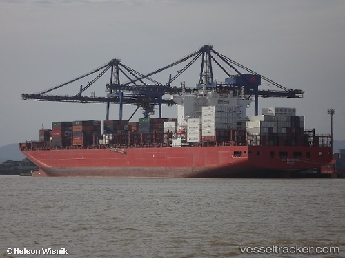
 San Fernando
Current Status
Where is the vessel?
San Fernando is currently in 99 nm E of Shitan, based on AIS data received less than 1h ago.
Latest AIS update:
Current position: 22.76973° N, 112.01750° W (99 nm E of Shitan)
Average speed (last 7 days): Loading…
Average speed (last 30 days): Loading…
Vessel profile: San Fernando is a Container Ship with dimensions 300m x 48m.
This page combines live AIS, route history, probable destination signals, nearby traffic, and port activity for practical vessel monitoring.
The current position of vessel San Fernando is 22.76973 lat / -112.01750 lng. Updated: 2026-05-16 06:06:01 UTCNearest reference points:
- 99 nm SE of Shitan
- 73 nm W of Los Cabos
- 71 nm W of Los Cabos
Currently sailing under the flag of Marshall Is ![]()
Details:
Live Vessel San Fernando Analytics (details, animations, etc.)
Recent AIS points (UTC):
2026-05-16 01:35:14 UTC · 22.26620, -110.88415 · SOG 15.7 kn · COG 298°2026-05-16 04:09:37 UTC · 22.55848, -111.53021 · SOG 15.5 kn · COG 296°
2026-05-16 04:50:50 UTC · 22.63250, -111.70524 · SOG 15.3 kn · COG 296°
2026-05-16 06:06:01 UTC · 22.76973, -112.01750 · SOG 14.8 kn · COG 303°